
Manhattan concept precinct
ITA North American headquarters · 0.158 km²Regional command, operations, records and training on Manhattan.
 IntercontinentalTransatlantic
Loading destination. Please stand by.
New York Gateway Registry / 2140
The arrival railway retains its offshore alignment. Freight handling, command, distribution and military support occupy separate precincts on Manhattan, connected by a proposed tunnel system.
NY / CARTOGRAPHIC RECORD
Offshore arrivals. Manhattan handling, command and support. Separate tunnel connections.
Satellite / REFERENCE DRAWING
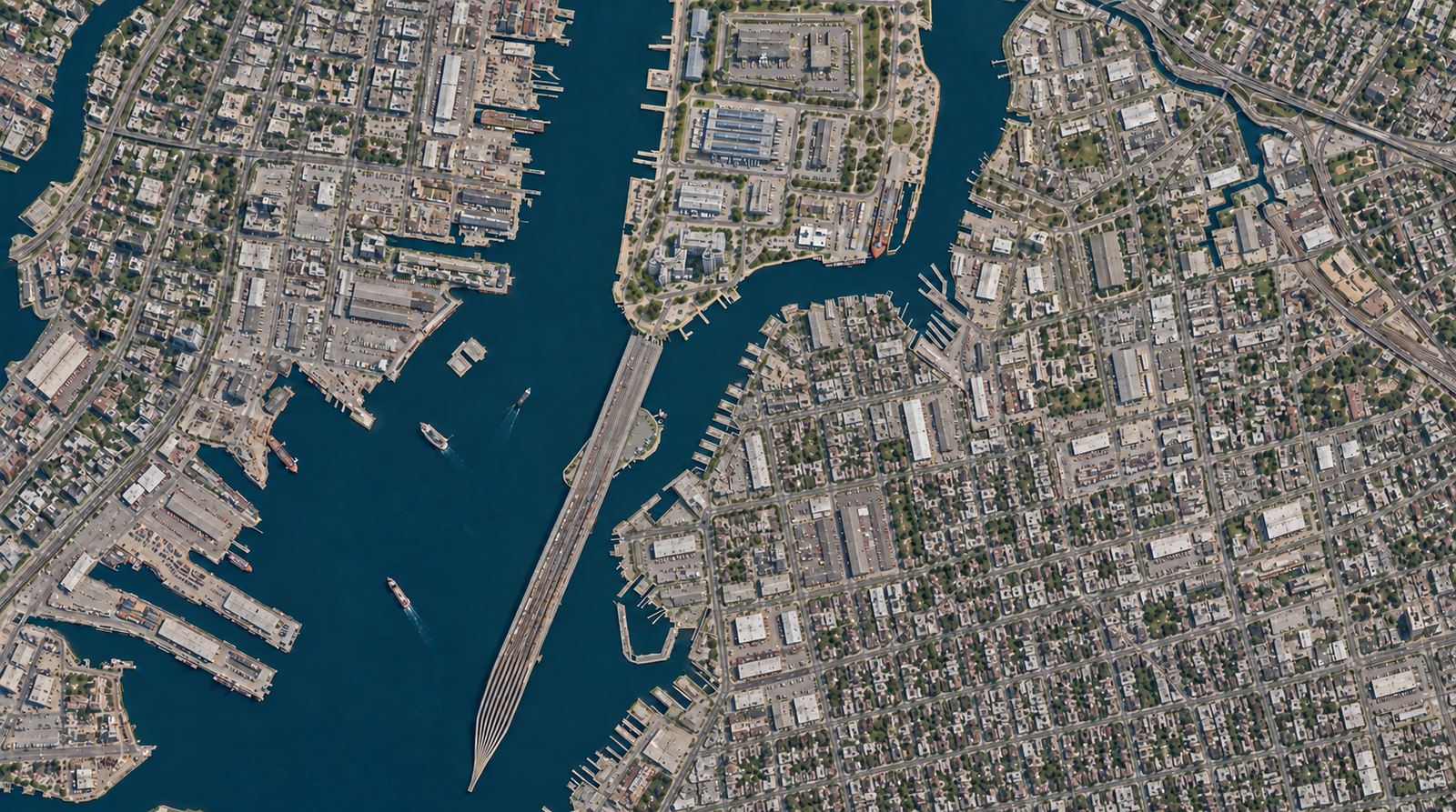
Offshore arrival tracks retain their registered alignment. The ITA complex is concentrated on Manhattan; New Jersey and Brooklyn are surrounding city context.
Drag to explore · Pinch or Ctrl + scroll to zoom · Keyboard: + / −, arrows, 0 for overview. Position and zoom are retained between views.
IMAGE LANDMARKS / 8 REFERENCES
Select a landmark to locate it across the five drawings. Numbers refer to visible features in this edition.
Illustrated positions. The bridge and railway retain their separate geographic register.
Street names belong to the fictional sector plan. Select a street to locate its traced alignment; zoom in to read nearby names.
The west-side industrial estate has been withdrawn. The Hudson remains open alongside the original railway corridor; the new ITA buildings stand on Manhattan. New Jersey and Brooklyn are surrounding city context.
Manhattan concept precinct
ITA North American headquarters · 0.158 km²Regional command, operations, records and training on Manhattan.
Manhattan concept precinct
Freight transfer and customs · 0.336 km²Enclosed transfer halls and underground handling floors receive freight from the offshore arrival tracks through the east transfer tunnel.
Manhattan concept precinct
Continental tunnel reception · 0.308 km²A separate underground receiving terminal connects to the mainland freight interface beneath the Hudson. No connection is drawn through the ITA buffer stops.
Manhattan concept precinct
Military support estate · 0.546 km²A secured Manhattan precinct with command buildings, barracks, workshops and its own access. Underground support levels form part of the fictional 2140 redevelopment.
Manhattan concept precinct
Manhattan harbour interface · 0.045 km²Shore-side cargo transfer and barge handling on the East River waterfront. Water beyond the quay remains open.
Manhattan concept precinct
Gateway utilities · 0.122 km²Power conversion, maintenance and emergency support within the island estate.
These are surface allocations for a fictional 2140 redevelopment, not current properties or an engineering approval. The former 35 km² programme is superseded; underground accommodation is not included in the surface areas shown.
The original 24 terminating tracks retain their coordinates, 3 km stopping sections, 18 m spacing and 3 km approach fan. The operating envelope now accommodates trains up to 2 km long, with 50 m clearance at each end. Train markers identify the centre of each formation, not its drawn length.
The east transfer tunnel links the arrival estate to Manhattan handling. A separate continental freight tunnel reaches the underground receiving precinct from the mainland. Both are local concepts; they are not additional scheduled Continuum routes and do not connect through the existing buffer stops.
All five views use an 18.00 × 10.05 km north-up frame. A 2 km train is 11.1% of its width. Open Concept tunnels to inspect the connections; landmark descriptions remain in the side panel.
Inspect Manhattan and the preserved tracks on Network →Coastline reference: NYC Department of City Planning and NJDEP. Generated illustrations are approximate; Network projects the source geometry directly.